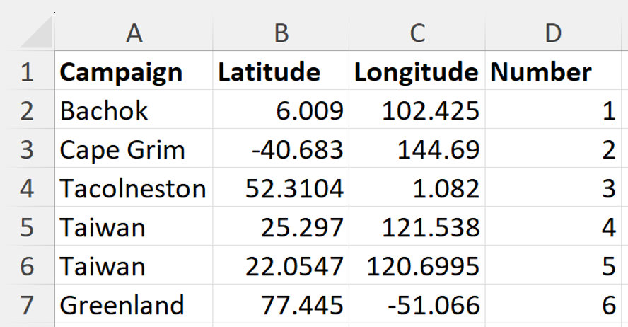
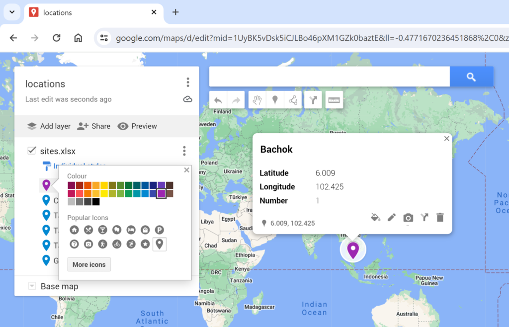
MyMaps is part of Google Maps. You can import spreadsheets into MyMaps in order to plot your own locations. In this example, I have an excel spreadsheet of six sites, with latitude and longitude coordinates.
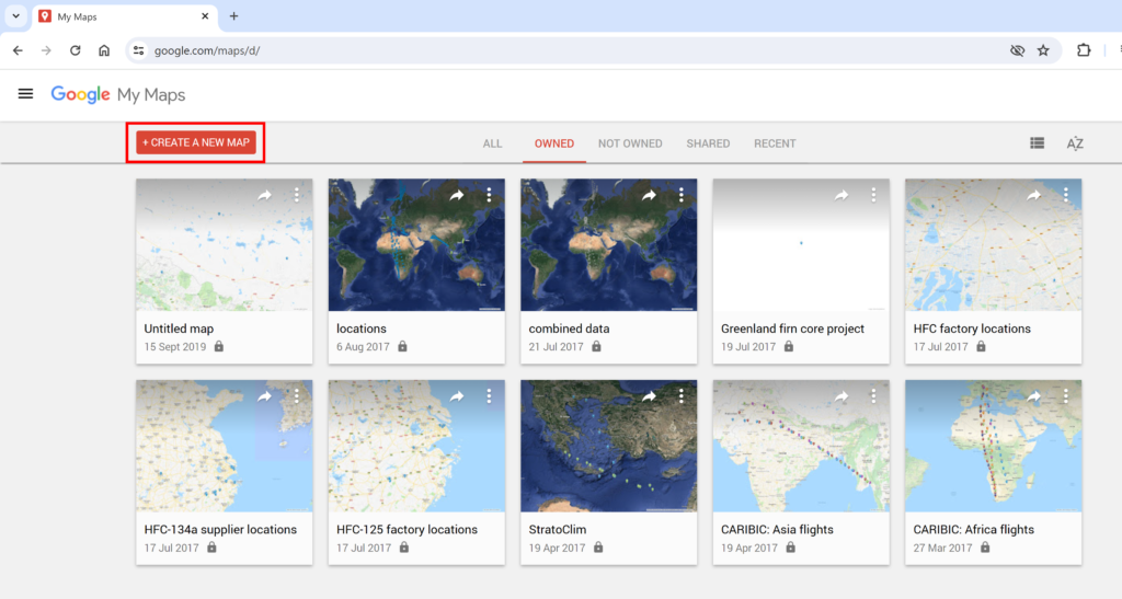
Firstly, go to the Google MyMaps webpage www.google.com/maps/d/ you will need a Gmail Account to do this. Click on CREATE A NEW MAP.
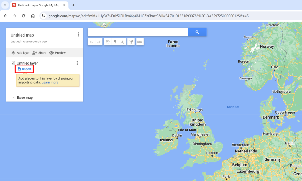
This will open a blank map. To get your own data into the map, click on Import.
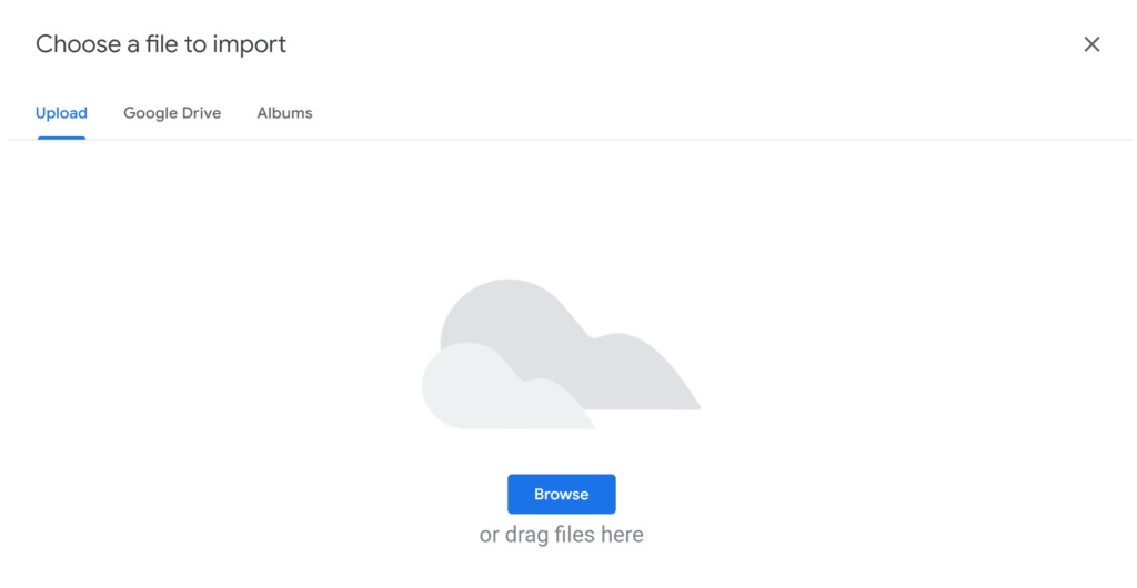
Then import the excel spreadsheet with your data in it.
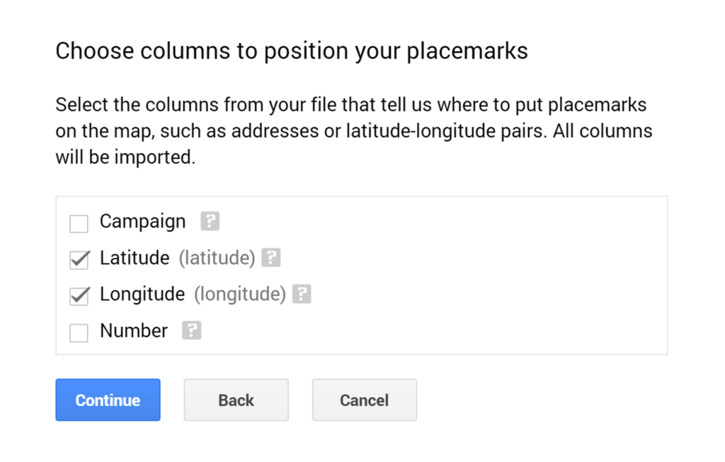
MyMaps is smart enough to figure out the columns with the headings Latitude and Longitude and the latitude and longitude coordinates. Click on Continue.
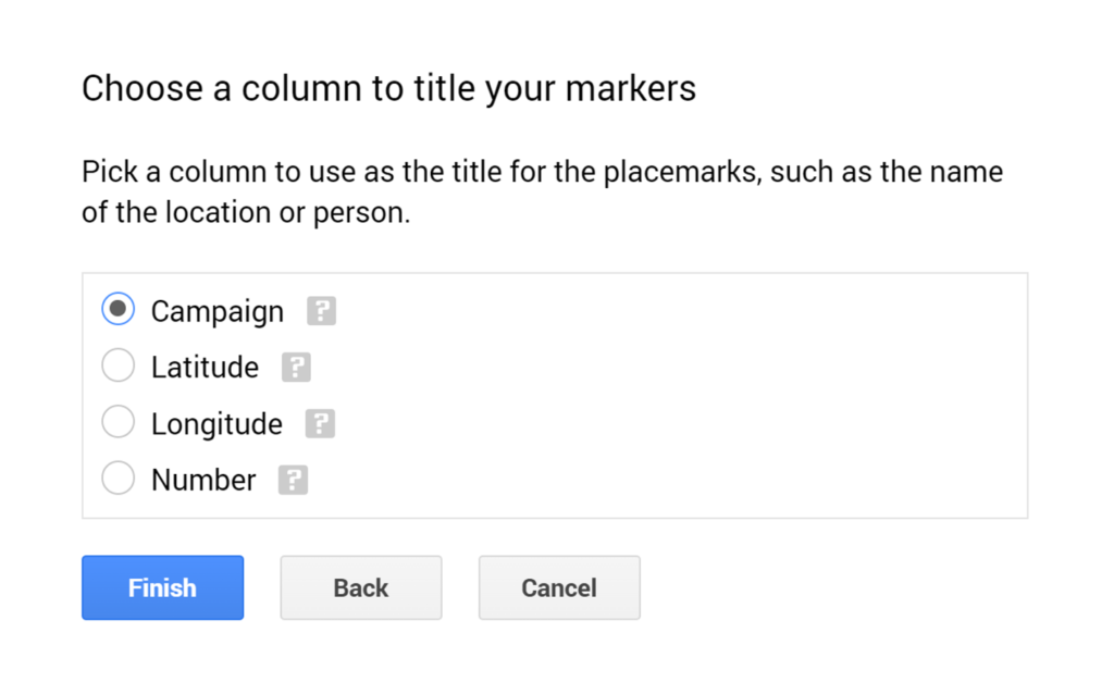
Choose the column heading that has the names for your locations. In this example, the column is called Campaign. Click on Finish.
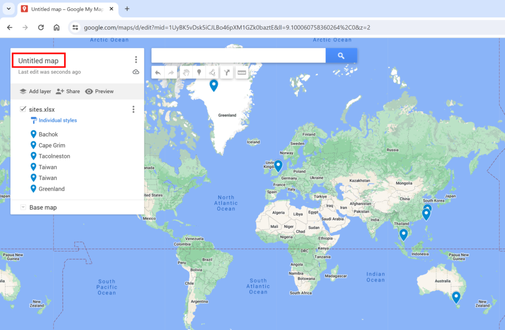
To change the name of the map, click on Untitled map.
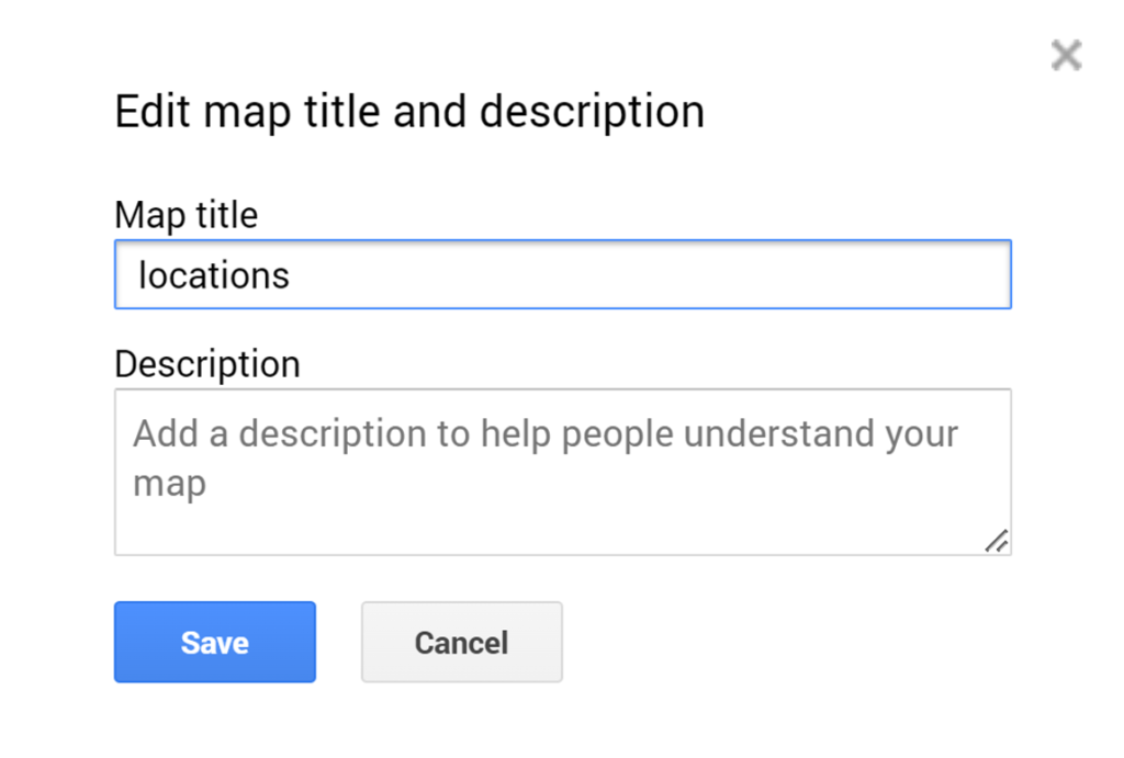
Then type in the map title that you want and click Save.
You can change the color of the markers inidividually by clicking on the paint can.
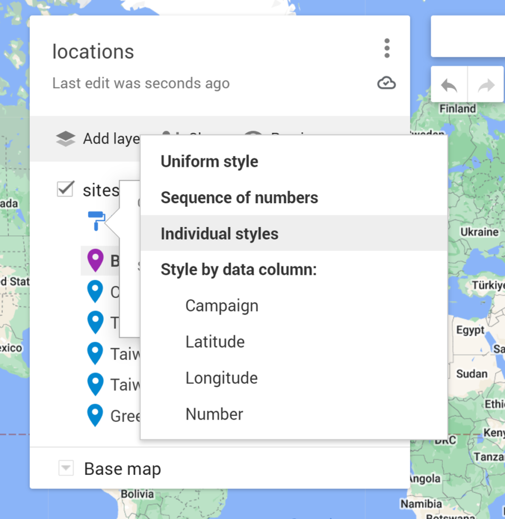
You can also change the style of all the markers as once by clicking on the paint roller and choosing one of the other options.
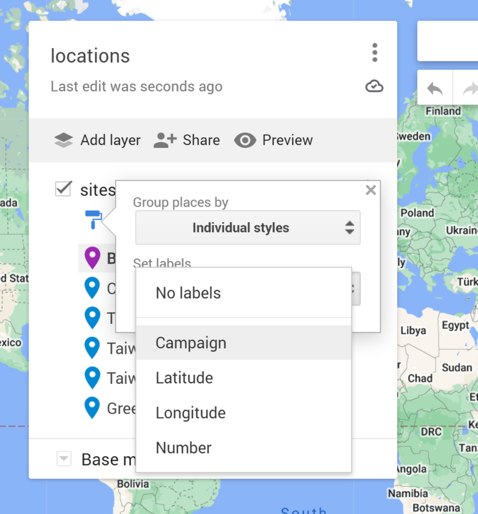
You can also add labels to the markers using one of the columns in your spreadsheet.
To change the appearance of the markers, click on the paint can, and choose More Icons.
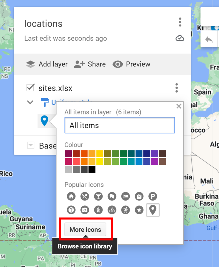
Then choose one of the available icons, or select Custom icon.
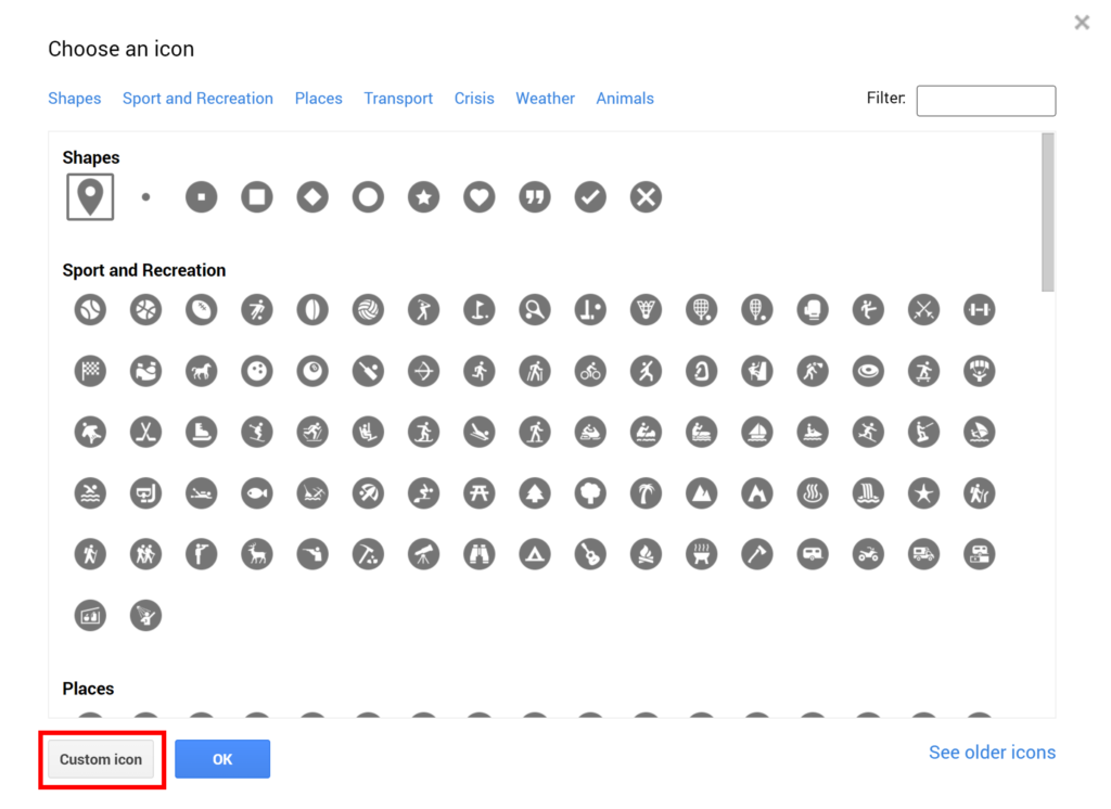
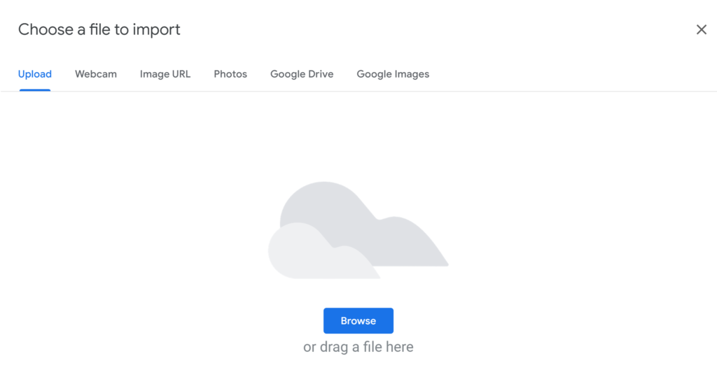
Then select an image file to use as your custom icon.
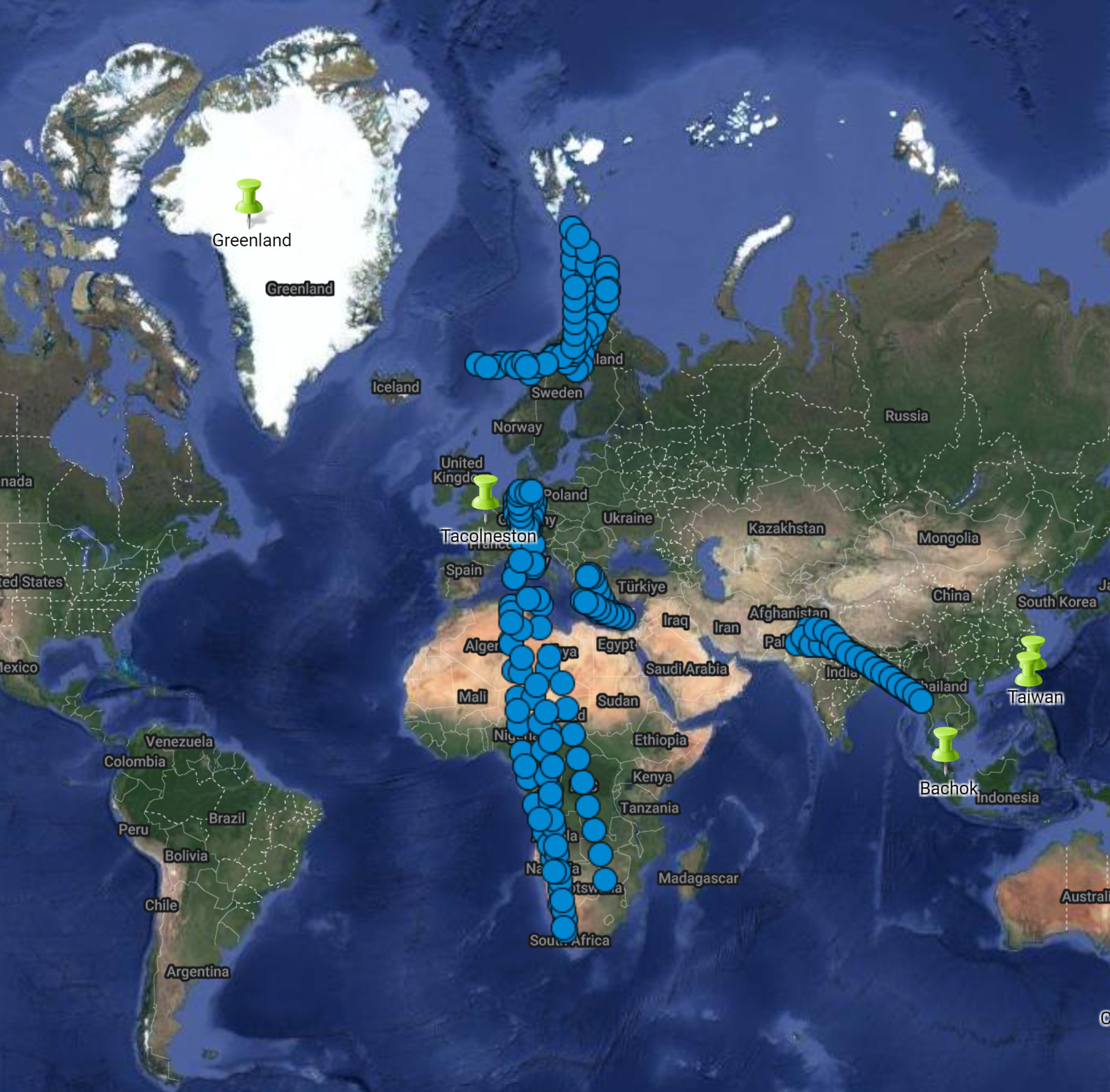
In this example, the markers have been changed to green pins.
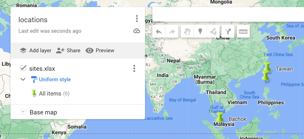
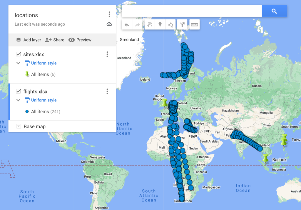
Next, I added in another layer using a different excel spreadsheet.
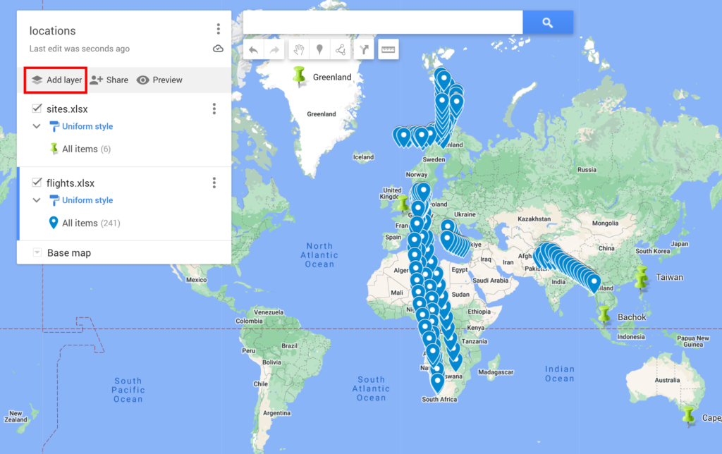
For this layer, I also changed the icons. This time I selected See older icons.
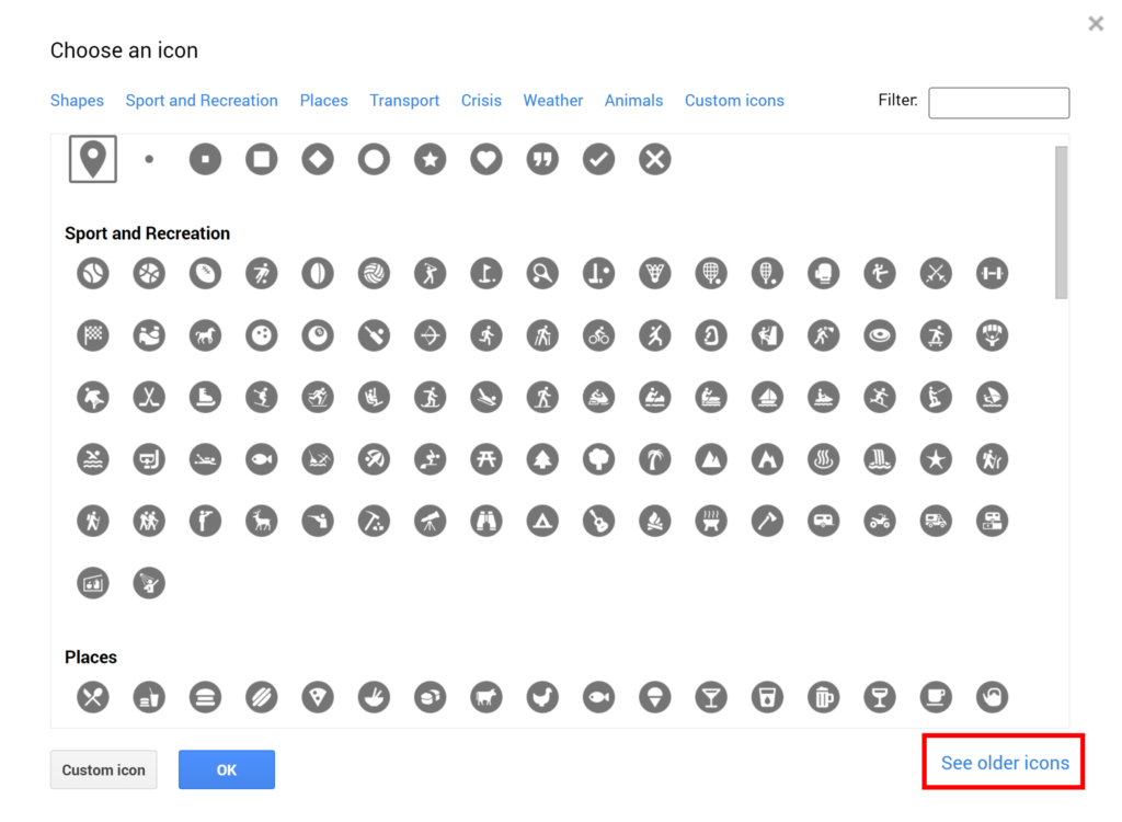
Then I selected the circle shape.
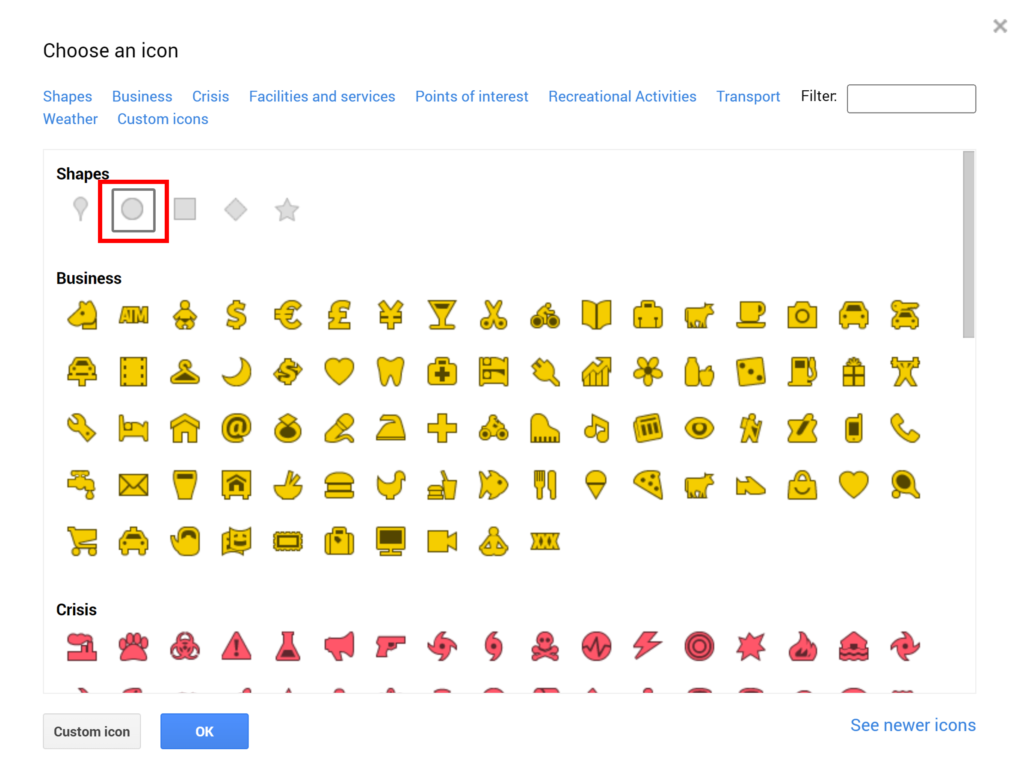
This changes all the markers for the second layer to circles.
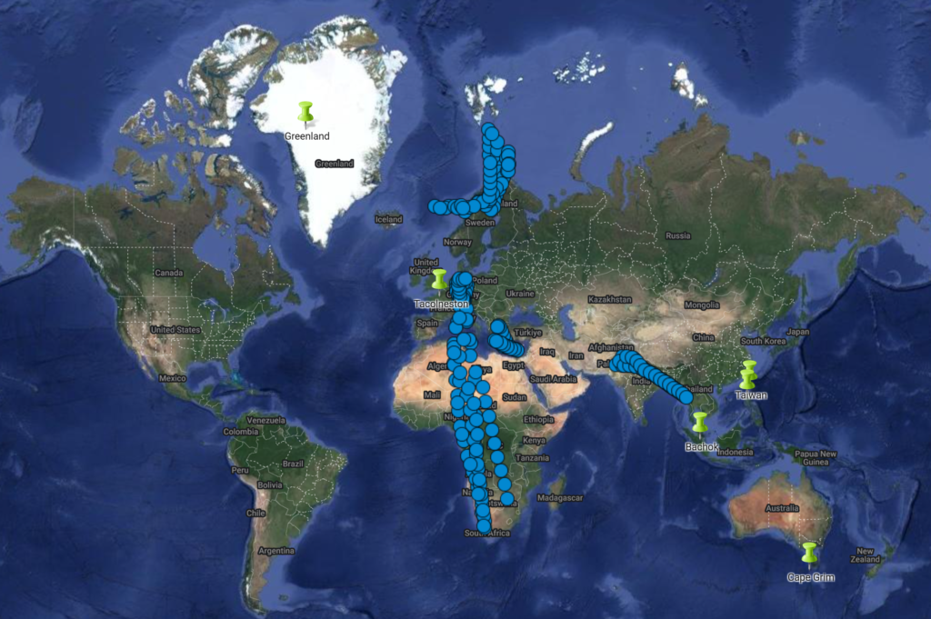
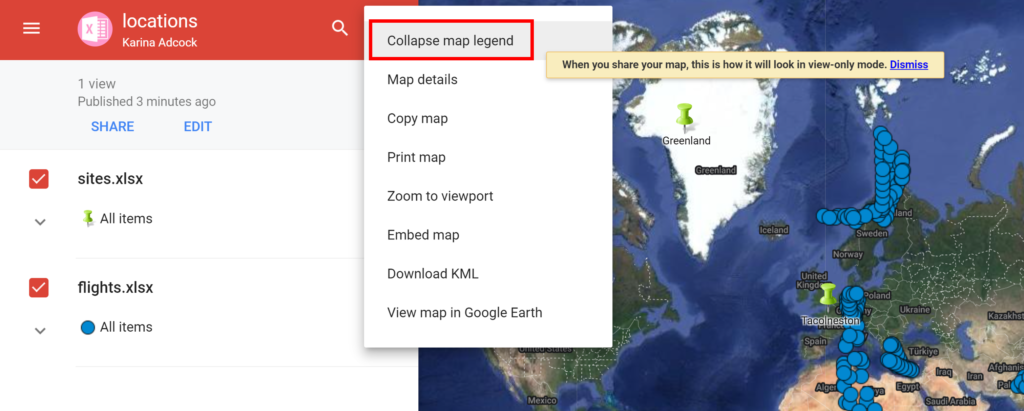
To change the map, click on Base map and then select one of the nine different map types available. Next, click on Preview to see the map on its own without the options box or the search bar.
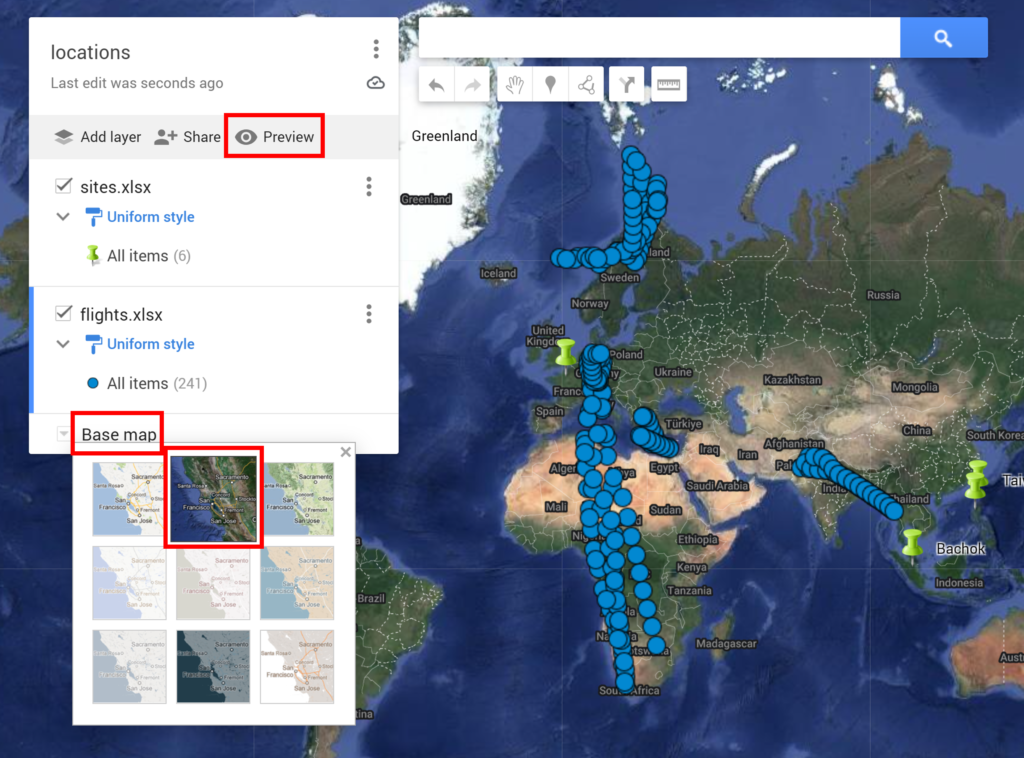
In the preview window, select Collapse map legend to remove the left hand pane. Dismiss the warning message. Then take a screenshot and crop it to get the map as an image that you can use later.
This is what the final map looks like.